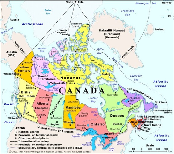
Map Of The Provinces And Territories:
BRITISH COLUMBIA:
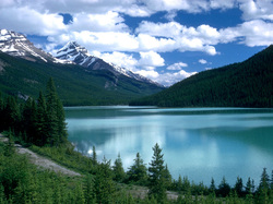
Known for it's natural beauty British Columbia is the westernmost province.
In 1858 Queen Victoria chose it's name.
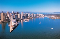
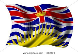
It became the sixth province of Canada on 20th July 1871.It's capital city is Victoria and largest city is Vancouver.The flag was adopted on June 27th 1960 and coat of arms in 1906 and modified in 1987.
Estimated population of British Columbia was 4,419.974 in 2009.
57.3%of the popultaion come from one of the British nations.Asians are the largest minority.
&5% of the province is mountanious and 60% is forests and 5%is arable land.
The province has mild , rainy oceanic climate.
Due to this it is rich in agriculture,the mild climate allows good tourism and outdoor activities.
Many rare mammals still live here like bear,elk, moose ,caribou etc. Many kinds of fish are also
found here.
Forestry and mining are its main resources.
British Columbia contains seven of Canda's parks, eg Glacier National Park,Gulf Island's National
Park Reserve.
The flower of British Columbia is Pacific Dogwwod,it's tree is Western Red Cedar,bird is Stellar's
Jay.
The province also hosted the 2010 Winter Olympics. Water sports are widely enjoyed here as
well as skiing and other sports like soccer,hockey,lacrosse,figure skating etc.
Special attractions include Fort Langley,Fort Steele and Barkerville.B.C offers cultural and
community events.
In 1858 Queen Victoria chose it's name.
It became the sixth province of Canada on 20th July 1871.It's capital city is Victoria and largest city is Vancouver.The flag was adopted on June 27th 1960 and coat of arms in 1906 and modified in 1987.
Estimated population of British Columbia was 4,419.974 in 2009.
57.3%of the popultaion come from one of the British nations.Asians are the largest minority.
&5% of the province is mountanious and 60% is forests and 5%is arable land.
The province has mild , rainy oceanic climate.
Due to this it is rich in agriculture,the mild climate allows good tourism and outdoor activities.
Many rare mammals still live here like bear,elk, moose ,caribou etc. Many kinds of fish are also
found here.
Forestry and mining are its main resources.
British Columbia contains seven of Canda's parks, eg Glacier National Park,Gulf Island's National
Park Reserve.
The flower of British Columbia is Pacific Dogwwod,it's tree is Western Red Cedar,bird is Stellar's
Jay.
The province also hosted the 2010 Winter Olympics. Water sports are widely enjoyed here as
well as skiing and other sports like soccer,hockey,lacrosse,figure skating etc.
Special attractions include Fort Langley,Fort Steele and Barkerville.B.C offers cultural and
community events.
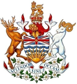
BRITISH COLUMBIA COAT OF ARMS:
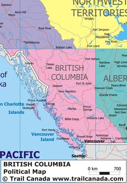
Map Of British Columbia:
FLAG OF BRITISH COLUMBIA:
ALBERTA:
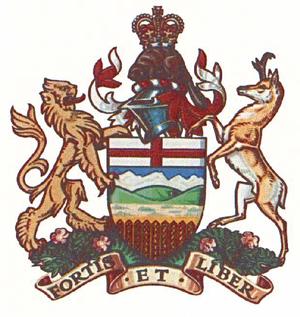
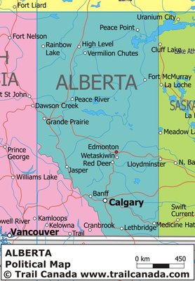
Alberta is one of the three prairie provinces of Canada.It has an estimated population of 3.7 million as recorded in 2010.It became a province on September 1,1905.The capital city of Alberta is Edmonton.Alberta was named after Queen Victoria's fourth daughter ,Princess Louise Caroline Alberta and Prince Albert.Alberta's motto is "strong and free".English is the official language of the province.Alberta is the fourth largest province of Canada.Alberta has a dry continental climate with warm summers and cold winters.Wild Rose is the provincial flower of Alberta,Lodgepole Pine is the provincial tree and the Great horned Owl is the provincial bird.The brighton sheep is Alberta's provincial animal.Alberta's main resources are the oil sands and it is a producer and exporter of natural gas.Agriculture is important to Alberta,wheat and canola are the main farm crops.In Alberta you can find people from different origins immigrants from England,Scotland,Ireland and Europe.There are a lot of french speaking people in Alberta.Alberta is a tourist destination,attractions include malls,like the west Edmonton Mall,outdoor festivals,parks like the Jasper National park and events like the Calgary Stampede.
Blue and gold are the official colours of Alberta,and it's motto is"strong and free".
Blue and gold are the official colours of Alberta,and it's motto is"strong and free".
ALBERTA COAT OF ARMS:
MAP OF ALBERTA:
FLAG OF ALBERTA:
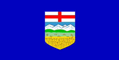
The flag was adopted on June 1st 1968.
SASKATCHEWAN:
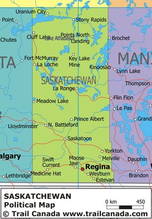
It is one of the prairie provinces.The capital city is Regina and largest city is Saskatoon.It became a province on September 1,1905.It's population is estimated at 1,049,701.Most of the people live in the southern half of the province.Many early setters settled here as well as the aboriginals and immigrants.It got it's name from the Saskatchewan River.The official language here is english.The official flower is Western Red Lily,tree is the Paper Birch and the bird is the sharp talied Grouse.The provincial colours are gold and green.The centre of the province has humid warm climate , a part of the province has dry climate and the northern part has sub arctic climate.Agriculture is important to the province.Wheat is the most common crop here.oil and natural gas are found here along with forestry ,fishing and hunting and mining which are also common industries.It has some famous historical sites like the Wanuskewin Heritage Park.
SASKATCHEWAN COAT OF ARMS:
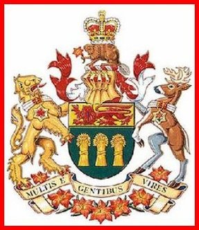
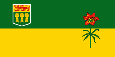
The coat of arms was granted by Queen Elizabeth in 1986.
MAP OF SASKATCHEWAN:
FLAG OF SASKATCHEWAN:
MANITOBA:
Manitoba is a prairie province in the heart of Canada also called "the land of 100,000 lakes".Winnipeg is the capital city of this province.It joined the confederation on July 15 ,1870.It's main industries are manufacturing, agriculture,hydroelectriciity and mining.It's name comes from either the ojibwa word "manito-bah" or the Cree word "manito-wapow".The provincial flower is prairie crocus,white spruce is the provincial tree,great grey owl the provincial bird.Mnitoba has extreme continental climate.Manitoba is home to many types of animals ,for example, the polar bear,moose, deer,wolves.Manitoba has a population of 1,213,815.60% of this population lives in Winnipeg.French and English are the official languages here.Most of the people in Manitoba are English,the aboriginal community here is increasing.The main resources are tourism ,oil ,energy,agriculture,mining and forestry.Manitoba holds many festivals like Folklorama,it is also known for it's museums like the living Prairie Museum.
MANITOBA COAT OF ARMS:

MAP OF MANITOBA:
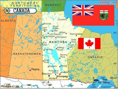
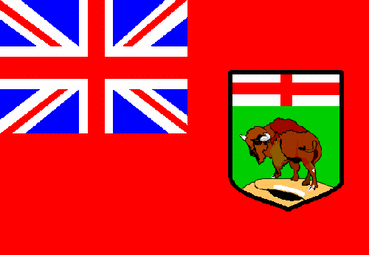
FLAG OF MANITOBA:
ONTARIO:
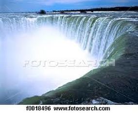
Ontario is located on the east-central part of Canada.The capital of Ontario is Toronto.Ontario is the largest province by population and second largest by area.Ontario has two regions Northern Ontario and Southern Ontario.Ontario is named after the Lake Ontario,which is comes from a Huron word "Great Lake".Ontario has about 250,000 lakes.Ontario has warm,humid summers and cold winters.Ontario has no officil language,but english is commonly spoken here.Most of the people in Ontario come from British and European background.There are many immigrants too in Ontario. It has a population of 13,210,667.Ontario has a big manufacturing industry.Ontario joined the confederation on July 1,1867.The provincial flower is White Trillium,provincial tree is Eastern White Pine,and bird the Great Northern Loon.Ontario has many natural resources eg:water ,natural gas,forests and wildlife,minerals and mining and energy.It has many tourist attractions here some of the favourite attractions being the Niagra Falls,C.N Tower,Wonderland.
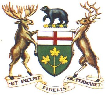
ONTARIO'S COAT OF ARMS:
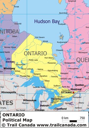
MAP OF ONTARIO:
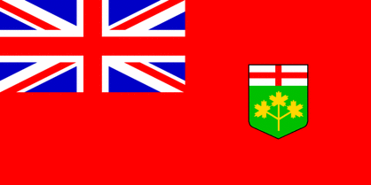
FLAG OF ONTARIO:
QUEBEC:
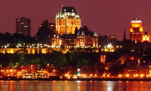
Quebec is the largest province in area and is a french speaking province.It's capital city is Quebec City.It joined the confederation on July 1,1867.The climate here is mild,it has mild spring followed by hot summer,a chilly autumn and a very cold winter and snow.Most of central Quebec has subarctic climate,and north of Quebec has arctic climate.Quebec has more than 1 million lakes and waterways.Most of the people living here are french speaking.The official language here is frenral ch.The provincial flower is Blue Flag Iris,the provincial tree is Yellow Birch,the provincial bird is Snowy Owl.The name Quebec comes from an algonquin word meaning "where the river narrows".The Canadian Space Agency is in Quebec.Some common festivals here are the winter carnival,summer festival.The natural resources of Quebec are silver,gold,copper and iron,hydro electric power ,paper and pulp.
QUEBEC COAT OF ARMS:
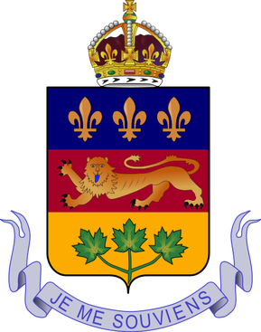
Was granted by Queen Victoria on May 26 ,1868.
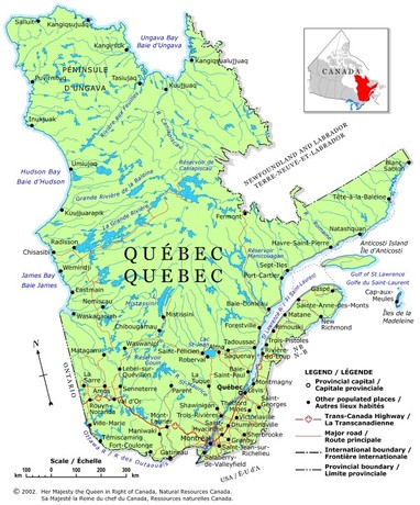
QUEBEC MAP:
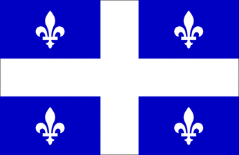
FLAG OF QUEBEC:
NEWFOUNDLAND & LABRADOR:
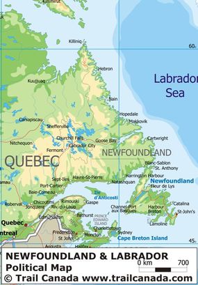
This province is located in eastern Canada and it has two parts ,the island Newfoundland and mainland labrador.The capital of the province is St.John's.The official language is English.The provincial flower is Pitcher Plant,the provincial tree is Black Spruce,and the provincial bird Atlantic Puffin. The official animal is caribou.Newfoundland has a cool summer and labrador has cold tundra climate.The population here is 509,200.This province joined the confederation on 31 March, 1949.The natural resources are fishing ,mining,forests,tourism,energy,oil ,pulp and paper.The province is famous for some historic sites like Cape Spear,national parks like Gros Morne and so on.
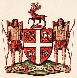
NEWFOUNDLAND & LABRADOR COAT OF ARMS:
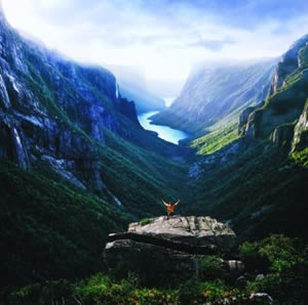
MAP OF NEWFOUNDLAND AND LABRADOR:
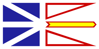
FLAG OF NEWFOUNDLAND AND LABRADOR:
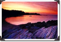
NOVA SCOTIA:
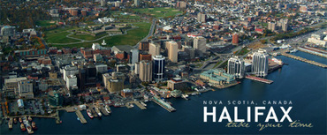
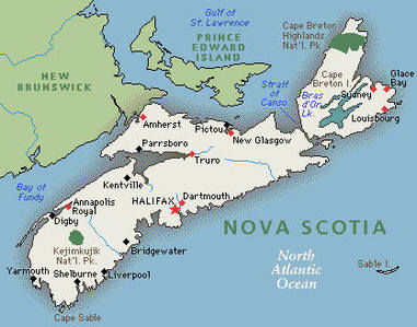
Nova Scotia is surrounded by the Atlantic Ocean,and is know for it's high tides,lobster,fish,blueberries and apples.Halifax is the capital of Nova Scotia.It joined the confederation on July 1,1867.It is the second smallest province in Canada.Many Mi'kmaq people live here.The official language here is English.The provincial flower is May flower,the provincial tree is Red Spruce,the provincial bird is Osprey.It has cold winters and warm summers.It is the warmest of the provinces in Canada.The population here is 944,251.Most of the people here are Scottish.Mining,fishing ,oil ,gas ,agriculture,paper are the main resources here.
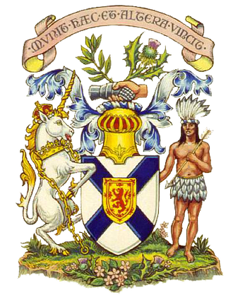
NOVA SCOTIA COAT OF ARMS:
MAP OF NOVA SCOTIA:
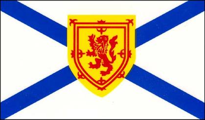
FLAG OF NOVA SCOTIA:
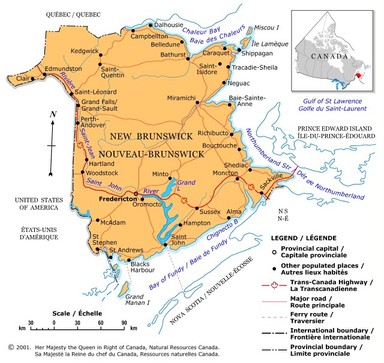
NEW BRUNSWICK:
New Brunswick is one of the three maritime provinces.It is a bilingual province (English and French).Fredericton is the capital city and St. John is the most populated city here.The population here is about 751,273.Most of the people are English speaking and the rest are french speaking.It became a province on July 1st,1867.The provincial flower is Purple Violet,the provincial tree is Balsam Fir and the provincial bird is Black -Capped Chickadee.Forestry ,farming,fishing,mining are the main industries here.zinc and lead are mined here.One of the most valuable crops here is potatoes.It has a large tourist industry.Some attractions include the New Brunswick Museum,Mactaquac Provincial Park, Parlee Beach,St.John's Reversing Falls,Magnetic Hill Zoo and so on. 85% of the province is covered by forests.
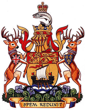
NEW BRUNSWICK COAT OF ARMS:
MAP OF NEW BRUNSWICK:
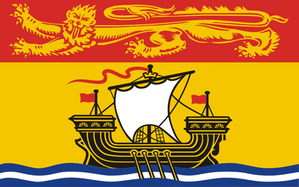
FLAG OF NEW BRUNSWICK:
The flag was adopted on Feb 24,1965.
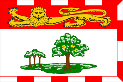
PRINCE EDWARD ISLAND:
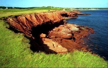
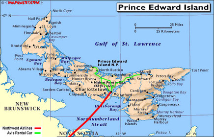
This is one of the Atlantic / Maritime provinces.It is the smallest of all provinces.The capital city is Charlottetown.It was named "Prince Edward" after Queen Victoria's father in 1799.It is called the "garden province"because half the land is cultivated.The provincial flower is Lady's Slipper,the provincial tree is the Northern Red Oak,the provincial bird the Blue Jay.The population is about 138,600 approximately.Over 75%of the people are Scottish,Irish and English, and 15% are French origin.Charlottetown is the largest city and Summerside is the only other city.The first people to live here were the Mi'kmaq.The province is about 224 km and 6 t0 64 km wide.There are no major lakes or rivers here only brooks,streams and ponds.Prince Edward Island National Park has a large beach.There are over 90 beaches here.The climate here is mostly mild.It is a very windy island.Agriculture is the largest industry here.30% of Canada's potatoes are grown here.Other crops include strawberries,carrots, onions,apples, cereal crops.Almost half of the land is used for farming.The second largest industry is tourism.Fishing is the third largest industry.Green Gables House is a famous tourist attraction.The Confederation Bridge connects New Brunswick and PEI.
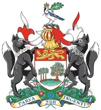
P.E.I COAT OF ARMS:
MAP OF P.E.I:
P.E.I FLAG:
TERRITORIES OF CANADA: YUKON,NORTHWEST TERRITORIES &NUNAVUT.
YUKON:
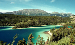
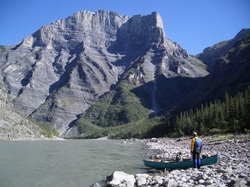
The Yukon forms a large triangle on the northwest of the mainland of Canada.The capital of Yukon is Whitehorse.It entered the confederation on June 13th, 1898.The highest mountain of Canada Mount Logan is in Yukon.80% of Yukon is wild.Yukon takes it's name from a native word yu-kun-ah wich means "great river".The provincial bird is the Common Raven,the flower- Fireweed ,the provincial tree is White Birch.It has a population of almost 32,000 people.More than 22,000 people live in the capital Whitehorse.Fourteen of the First Nations live here,8 languages are spoken here.The climate here is sub arctic,winters are cold with long dark nights and summers mild with long sunny days.Mining and tourism are important industries here.The fur trade is the oldest indusrty in the Yukon.The official languages here are English and French.Some of the famous festivals here are the Yukon International Storytelling Festival,Frostbite Music Festival and others.Every Yukon community is served by an airport.
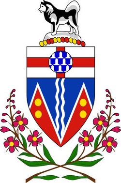
YUKON COAT OF ARMS:
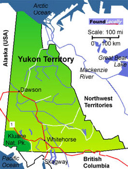
MAP OF YUKON:
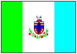
YUKON FLAG:
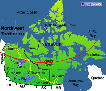
NORTHWEST TERRITORIES:
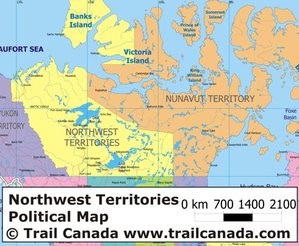
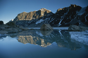
This province is in the western Arctic of Canada.Yellowknife is the capital city .It entered the confederation on July 15,1870.It borders Yukon and Nunavut to the east and three provinces to the south,British Columbia,Alberta and Saskatechwan. On the 1st April 1999 it was split to make Nunavut a territory.It has the Great Bear lake (the largest lake within Canada,the Mackenzie River,the canyons of Nahanni National Park Reserve and the UNESCO World Heritage Site.The population here is about 43,529.The Southern part of the territory has sub arctic climate and the north has polar climate.summers in the south are short but warm,winters are long and cold.It has 11 official languages including English and French and other Native languages.The resources include gold ,diamonds,natural gas and petroleum.It is a land of forests,mountains ,tundra,beautiful lakes,and is land to animals like the white wolves,white whales,bison,bears moose and caribou.It's flower is Mountain avens,tree the Tamarack Larch,and bird is the Gyrfalcon.
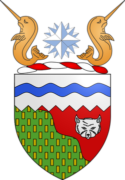
NORTHWEST TERRITORIES COAT OF ARMS:
MAP OF NORTHWEST TERRITORIES:
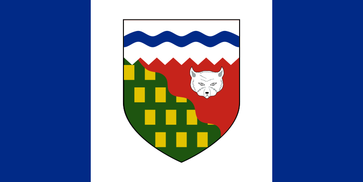
FLAG OF NORTHWEST TERRITORIES:
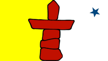
NUNAVUT:
Nunavut is the largest and theUT newest territory of Canada.It was seperated from Northwest Territories on April 1st 1999.The name Nunavut means "our land".The capital city is Iqaluit.The official languages are Inuit language,English and French.The population is about 29,474.The flower of this territory is Purple Saxifrage,the bird Rock Ptarmigan.This area is populated by the Inuit people.The climate here is bitterly cold in the winters and has cool to cold summers.The main resources here are iron and precious metals,diamonds,petroleum and natural gas.Fishing is also common here .some tourists come here for sport fishing and hunting.Mining is another big industry here.Winter sports such as hockey,curling,dogsled and snow mobiling are common here.
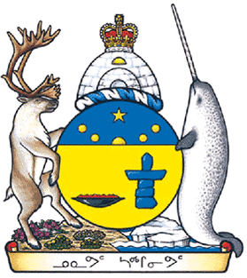
NUNAVUT COAT OF ARMS:
MAP OF NUNAVUT:
FLAG OF NUNAVUT: